Such beautiful flowers are all over the place. One of my favorite to see while in the woods is the Pacific Dogwood. This one is just opening.

Helping you succed in the outdoors.
Such beautiful flowers are all over the place. One of my favorite to see while in the woods is the Pacific Dogwood. This one is just opening.

Hey Guys, today I want to share with you a video on what I carry on a day hike. I have included the content list below.
This is a question I have been asked over and over. “What should I carry on a day hike”? While the simple answer could be as easy as, the 10 Essentials, it can also be a lot more. What I would like to point out here is that even someone who has never hiked before believes they should at least carry something! I ALWAYS carry a backpack or day pack with me on every hike. That being said, I suggest investing in a comfortable backpack in the 18-20 liter range. These can be purchased anywhere on any budget. I used one for a couple years from a low budget store that lasted long enough that I passed it on and upgraded to my current favorite bag to this date – the Osprey Talon 22 (22 liter). This bag is not only very comfortable, but holds everything I could ever cram into it for a day hike.
What are the 10 essentials? These are 10 systems you should always have with you. Some items, such as the satellite messenger can be valuable. I have plans to purchase one soon for some of my longer adventures. You may never use some of these things for months of hiking, but at some point, you may be in a situation where you really wished you had them, or even worse yet, you could end up in a situation where your safety depends on one of these items. Lets take a look at these items and if you aren’t sure what some of these things are, a quick internet search will fix that.
So you might wonder if you need everything listed in a particular system. For example, under Navigation, I would normally have my phone for photos. I also have apps on my phone with maps loaded that I can view when I am even out of cell coverage. However, it is my professional opinion that putting all your safety of staying found in an electronic device is about as smart as texting and driving – at some point you are going to be screwed. I will also carry a map and compass with me because it is a valuable tool that does not rely on power.
Having a tool and not knowing how to use it can get you in serious trouble or even dead! To make a point, here are some “tools” that can be deadly if you do not have proper training. In land surveying a machete is used, sometimes for hours, chopping through blackberries, better known as “weeds” in Cascadia. Not knowing how to use one could get your shin chopped in half, or worse, chop into someones head that you let get to close. A firearm is another “tool” that can be deadly without proper training. Same with map and compass. Having it in your bag is not going to save you. Enough said.
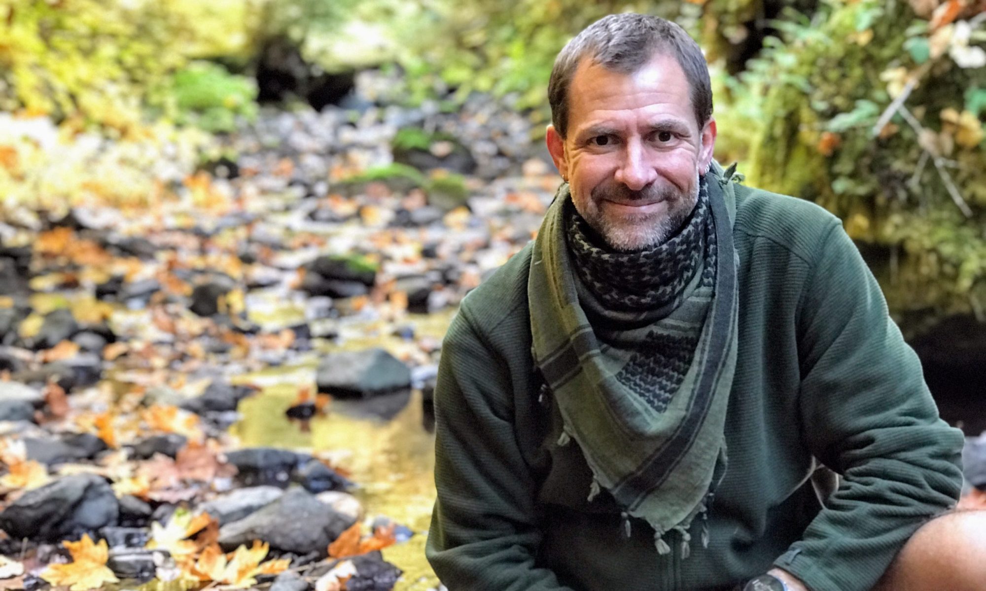
For the Fire system, I think it is wise to typically always have a mini Bic lighter and a tinderbox. I always carry a Ferro rod, which will work even when wet…a Bic will not work when wet. Most times I have two different items from the Knife system. As the seasons change, so does the contents of my day pack. Rain gear and my wool sweater usually are left out in the summer months – the two months of the year when it doesn’t rain. There are times I may carry a stove and food to cook a meal or coffee once I arrive at a scenic location such as in the image below. The best advice is to start with the ten and as you gain experience, adjust items you may want to add.

Below is the list of the equipment I went over in my video.

If this post has helped you, or should you have any questions, please leave them in the comment section. I also ask that you subscribe to my YouTube channel and blog to stay informed.
Adventure awaits!

Yesterday, We hiked to Fall Creek falls. This really wasn’t our destination though. The destination was Vivian Lake. We were hiking a trail that includes three waterfalls: Salt Creek Falls, Diamond Creek Falls, and Fall Creek Falls. The latter being the farthest from the others. The first falls (Salt Creek Falls) we have seen a million times and decided to go straight to Diamond creek falls and then Fall Creek Falls, which was up the mountain a ways.


The South Sister is located in the Three Sisters Wilderness, in Lane County Oregon. The Three Sisters are a complex volcano of three volcanic peaks of the Cascade Volcanic Arc and the Cascade Range in the U.S. state of Oregon. Each exceeding 10,000 feet (3,000Â m) in elevation, they are the third, fourth, and fifth highest peaks in the state of Oregon, and are located in the Three Sisters Wilderness, about 10 miles (16Â km) south of the nearest town of Sisters. Diverse species of flora and fauna inhabit the area on and around the mountains, which is subject to frequent snowfall, occasional rain, and extreme temperature differences between seasons. The mountains, particularly South Sister, are popular for climbing and scrambling.
Although they are often grouped together and seen as one unit, the three mountains evolved under differing geologic situations, and the petrologic composition of each mountain can vary significantly. Whereas North Sister is extinct and Middle Sister is dormant, South Sister last erupted about 2,000 years ago and still could erupt, threatening life within the region. After satellite imagery detected tectonic uplifting near South Sister in 2000, the United States Geological Survey made plans to improve monitoring in the immediate area.
South Sister, also known as “Charity,” is the youngest and tallest volcano of the trio. Its eruptive products range from basaltic andesite to rhyolite and rhyodacite.[16][33] It is a stratovolcano overlying an older shield structure.[5] The first such episode, termed the Rock Mesa eruptive cycle, first spread tephra from flank vents from the south and southwest flanks, followed by a thick rhyolite lava flow. The second cycle, the Devils Hill eruptive cycle, was similar in result, but was caused by the intrusion of a dike of new silicic magma that erupted from about 20 vents on the southeast side and from a smaller line on the north side.[35]
Unlike its sister peaks,[36] South Sister has an uneroded summit crater about 1â„4 mile (0.40Â km) in diameter that holds a small crater lake known as Teardrop Pool, the highest lake in Oregon.[37] The slopes of South Sister have a number of small glaciers, including the Lewis, Clark, Lost Creek and Prouty glaciers near the crater rim.[38]
*Information from Wikipedia.
I had first hiked the South Sister over 15 years ago with a friend. On that trip, we backpacked up to Moraine Lake in the evening and setup camp. In the early morning we hiked to the summit and then hiked all the way back to the car. The very next weekend after the climb, I went car camping at Wikiup Reservoir. You could see the South Sister from the camping spot and it was completely covered in snow.
A few months ago, I was approached by a different friend who asked me to join a group of guys who were going to climb the South Sister in August of 2016. I really wasn’t interested at first, but then I thought it would be a great accomplishment for my oldest son, who was, Interestingly enough, conceived the weekend after the aforementioned climb. Due to football season and other factors, however, my son was unable to make it on this trip. I decided to go anyway.
We met at Life Bible Church in Harrisburg, Oregon and planned to leave at 4:45 am (I’m not sure when we actually left). There were 11 of us riding in a passenger van, four of which I had never met before. The drive took about 2 hours and 30 minutes to get to Devils Lake Campground where the trailhead is located. We joined the 50 or more cars parked along the edge of the road and then headed out on our adventure. Do not plan on being alone on this hike. It seamed like there were hundreds of people out on the trail.

The first section starts by leaving Cascade Lakes Highway at Hell Creek (about 5,444 feet) and climbs roughly 1,076 of elevation gain through the forest to about 6,520 feet – mostly switchbacks (as one guy put it, it was “a slap in the face” start). This first section can really weed out those that aren’t truly up to the task of making the summit. I feel it’s best to warn you now… this first section is as easy as walking from your bedroom to the bathroom compared to the torture of climbing the last 2,000 or so feet of elevation to the summit! Once you come out of the forest, you come to the cross-trail to Moraine Lake. We stopped here for a a minute or two and moved on. The next section wasn’t really bad at all. The trail was wide and the elevation gain seemed minimal. This section is a good place to pass the slower groups of people headed up the mountain. The trees become further and further apart and the ground is real dusty. If you keep your eye to the right, you will spot Broken Top in the distance and Moraine Lake down in the valley below. 
As you leave the last area, the next section starts to get a little steeper with a lot more rocks. The trees become fewer and shorter and as you move above timberline the rocks turn to boulders. The boulders begin to dominate and at one point everyone is all over scrambling via their own path across a boulder field.
You eventually make it to a summit where a ton of people are resting at the Lewis Glacier. There is water at the base of this glacier and it is a great place to fuel up before the torture fest to to top begins. From here on out the trail gets steeper and tougher. 
After about 4 hours of hiking, we finally made the crest. In my opinion, I would consider this the “first” summit. As you come over the edge, the first thing you see is the Tear Drop Pool Glacier. When I saw it this time, I found myself saying to myself, “Wow, that glacier has really shrunk!”. For some reason it seemed like it was much higher to me from where I remember it 15 years ago. The second thing that some of us may notice once we reach the “first” summit is that the highest point of the mountain is on the far side of the glacier, I’ll call this the “Second summit”. You absolutely have to go over there because that is where you are able to view of all the north peaks from. 15 years ago, a well worn trail went strait across the glacier to that point, however, this time there was no glacier trail and a well worn trail traversed along the east rim – that must have been under the glacier when I was here before.
When you get to the second summit, you will notice that it drops straight down, frighteningly steep. If you search a bit you will find a ledge just below the highest point of the mountain, hanging out there. This was the only place to get out of the ferocious wind last time up. This time it wasn’t very windy. I remember sitting on that little ledge and some of the climbers sitting with me were talking about a lady that fell off that ledge to her death the weekend prior. Not sure if it was true or not, but i tell ya, if you fall over…your probably going to die. After resting while taking pictures, I decided to walk barefoot on the glacier before my decent. that felt so good on the feet!
I was finally ready to head back down. Of course, you would think it would be easy, think again. The thing I wasn’t prepared for was going down the torture section of scree. Your feet just slide and slide (see the video). I, however, was determined to get down as fast as possible. By the time you get through the third section (boulder section), your legs are so shaky you can barely keep yourself up. I passed lots of people, and you could see their legs shaking, just like mine, with every step. I hiked as fast as I could, without actually running, the whole way down. I just wanted to get to Devils Lake to cool my feet and body in the water. After about two and a half hours, I made it down and soaked in the lake. It felt so very nice! I then had two and a half hours to rest and soak before the last two guys made it back to the van.
Update: Now that I have finished typing this story I think I may do it again if any of my kids ever decide they want to climb it. I would love to do that with them!


(Information generated from GPX files)

It was a very blustery day, as Winnie-the-Pooh put it. However, we decided to hike to Kentucky Falls on the North Fork Smith River. We loaded up 5 kids, a dog, and headed out. To get there, I decided to follow my phones navigation instead of my maps. During our journey there the navigation led us through the Coast Range on various logging roads. It finally led us down one that was so overgrown on the edges that it felt more like a 1/2 lane road, or a goat trail. I felt safe knowing I could get there on this path, but if there happened to be a locked gate…it was going to be a very, very long drive back in reverse. I couldn’t help but think about that ordeal, years ago, where a family followed their Google Maps app from California and ended up perishing on some logging road here in Oregon.
We came upon a pretty steep clear-cut area and had to take a picture because of how steep it appeared. As we drove along this old back (logging) road, seemingly forever, the vegetation was so thick on the sides of the road that at times it was rubbing on the roof. It made me all the more astonished when we came upon a little clearing with a burned up car. What was this fella thinking. This really wasn’t some road you take a car on.
The first waterfall didn’t seem that far and it was nice, but we hiked on. All the while we were getting more and more wet. I chose not to bring rain gear because I wanted some idea of what the kids would be facing at any given moment. I stayed pretty dry and warm because of my wool sweater.
When we finally arrived at the lower waterfalls, it was well worth the hike, however, the little ones were totally soaked to the bone and cold. The first thing We noticed was the thundering from all the rain we were having. Next, I noticed that there were two falls cascading over a box canyon wall.
I instantly left everyone behind and went out off the deck towards the middle of the canyon. You had to jump from mossy boulder to boulder trying not to fall in the water. Once out there, amid all the noise, rushing water, waterfall spray, pouring rain and wind, I felt amazed and knew all my needs to get out into the outdoors had just been met. The chaos that was my calm. I was at peace inside once again.
I quickly made my way back to the viewing deck where my fiance had her arms around all the kids like a mother hen, trying to warm their soaked bodies. I gave her a kiss and we all headed back. I realized that I gained 20 pounds of water while I was out in the middle of that canyon. The hike back warmed us up…little. We got to the car after hiking back for 1.5 hours and drove the easier route home with the heat on high.
I am pretty sure we all had a wonderful adventure, and I thank my woman for knowing what I needed and helping me achieve it…as always. I love you!


